Turning Data Into Decisions, Faster
Drones, Digital Twin, Ai, Cyber Security, and more.
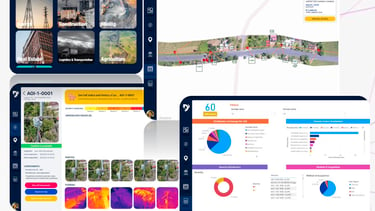
Precision Data for Business & Governance
Cutting-edge drone and AI solutions empower our clients to enhance their management capabilities.
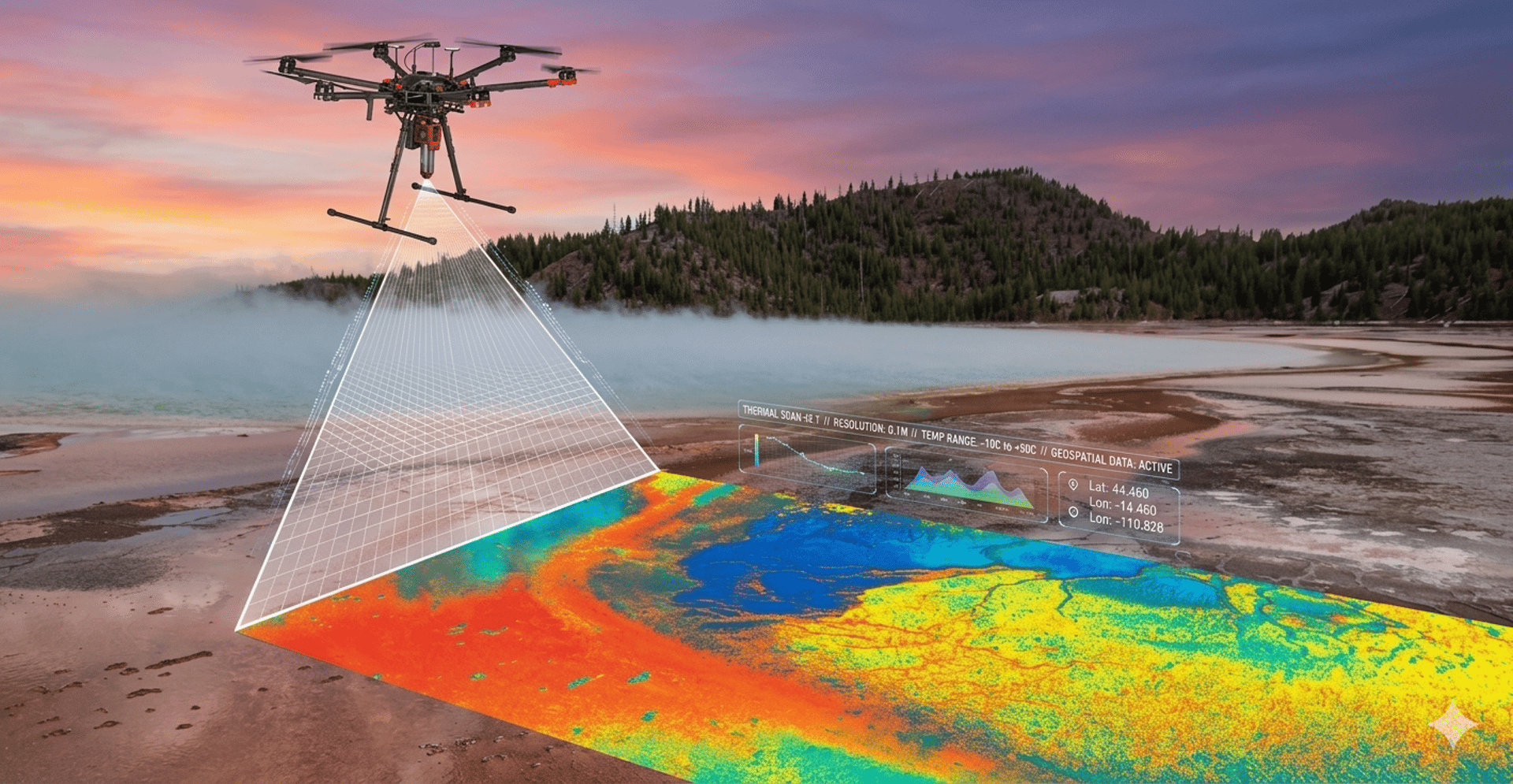
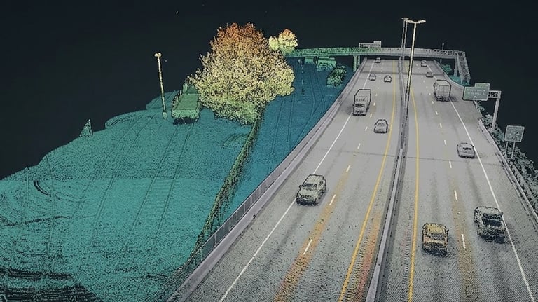
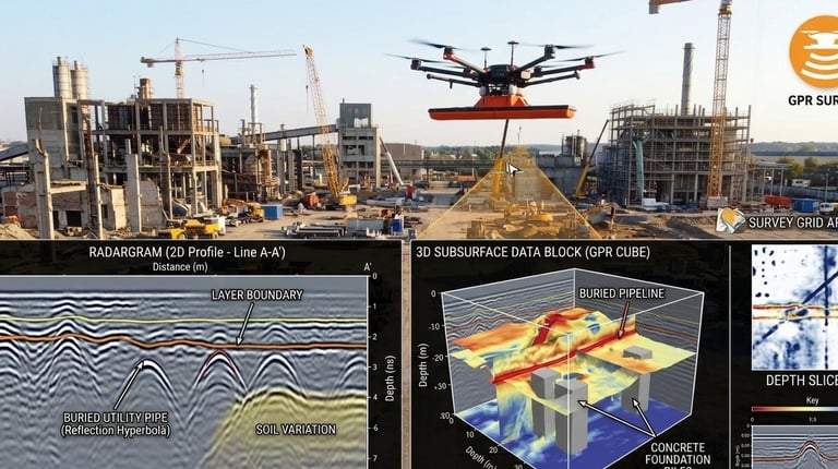
High-resolution geospatial data for planning and operations
Geotechnical and Geological insights for risk management
AI-driven project intelligence for accurate decision and planning


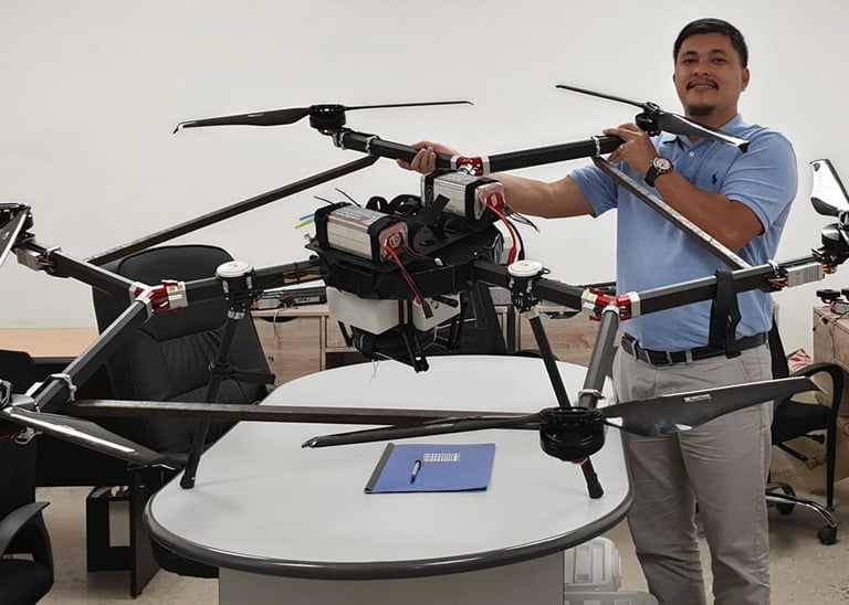
Precision Meets Innovation
At Data 360, we employ drones and artificial intelligence to provide business insights that help organizations make better-informed decisions.
50+
15
Trusted Partners
Clients
Precision in Every Data Point
At Data 360 Systems, we harness drone technology and AI to deliver geospatial insights that power major infrastructure.

Our Expertise
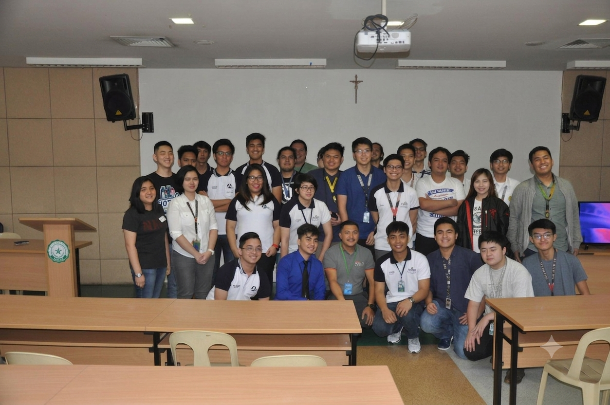
Our Partners
We work in partnership with academic institutions, government bodies, and private enterprises to promote decisions based on data that improve the resilience and efficiency of infrastructure.
Stay Informed
Get updates on our latest tech and events