Our Solutions
Precision Drone Digital Twin Data and AI insights
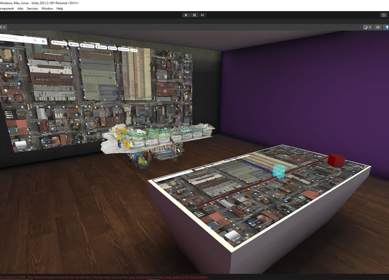
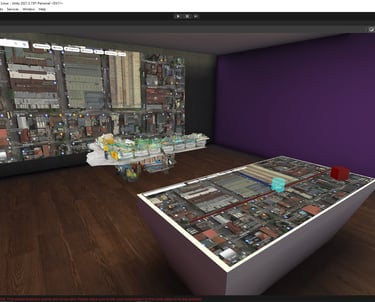
Geospatial Intelligence
Detailed terrain models for precise project planning and visualization.
Geotechnical and Geological Intelligence
Soil and rock analysis with drone assistance and high precision sensors for more secure foundations.
AI Intelligence
Sophisticated data analysis for both qualitative and quantitative evaluation aimed at enhancing decision-making.
Applications
Delivering precise data for infrastructure and development.
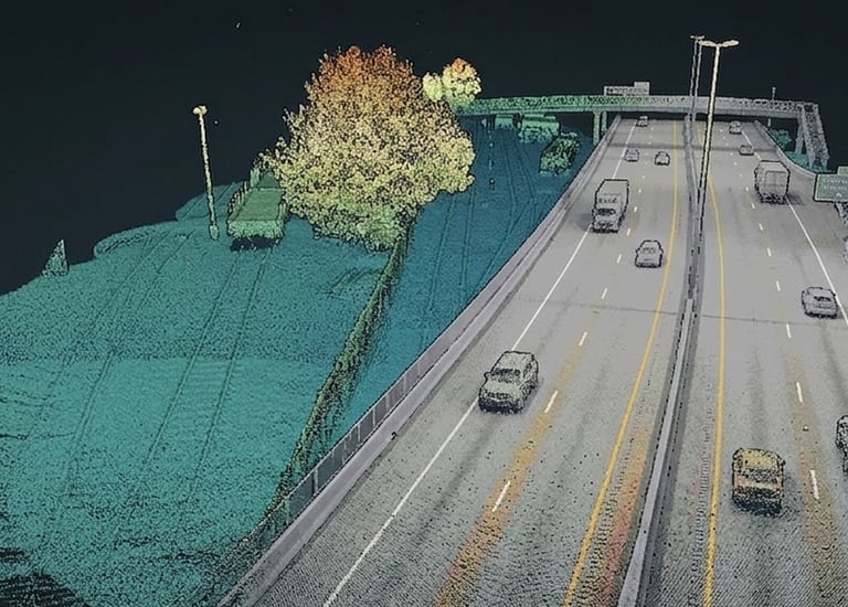
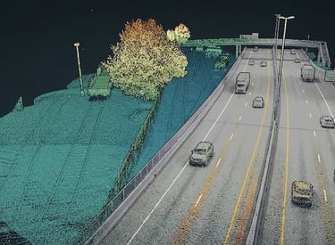
Highways and Railways
Geospatial Digital Twin for road development and oversight. Detects both qualitative and quantitative advancements.
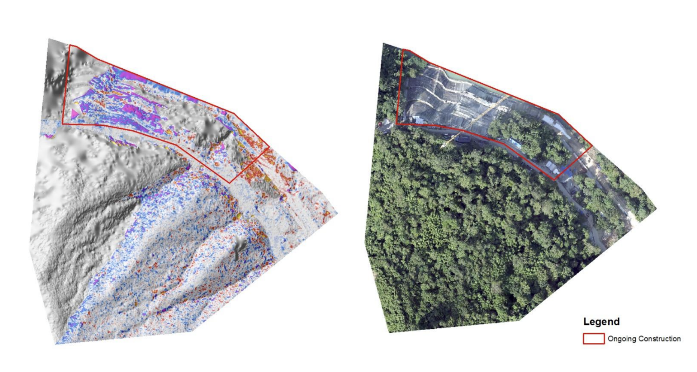
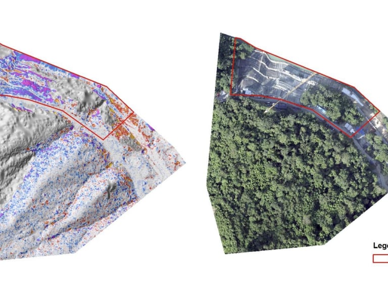
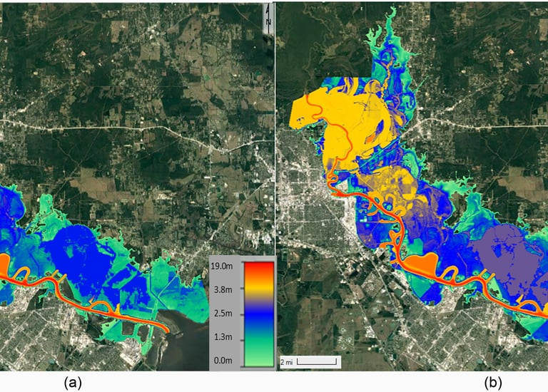
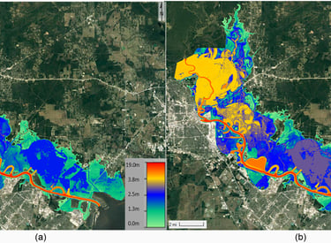
Dams
Analysis of slopes and measures for erosion control. AI-driven forecasting to predict landslides and provide geotechnical insights for secure foundations
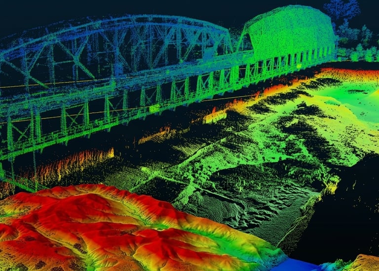
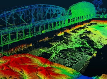
Bridges
Structural intelligence for safer builds and enhanced durability, ensuring that each construction project is not only structurally sound but also equipped with innovative solutions for modern challenges.
Urban Development
Intelligent data for urban infrastructure planning. A Digital Twin driven by A.I. to create diverse risk modeling methods, contrast development, and conduct a digital census.
→
→
→
→
Get in Touch
Reach out to Data 360 Systems for tailored drone and AI solutions.
Phone
+63-920-461-4741
info@data360systems.com