Precision Data
High-resolution and high-accuracy drone data for planning, design, and monitoring.
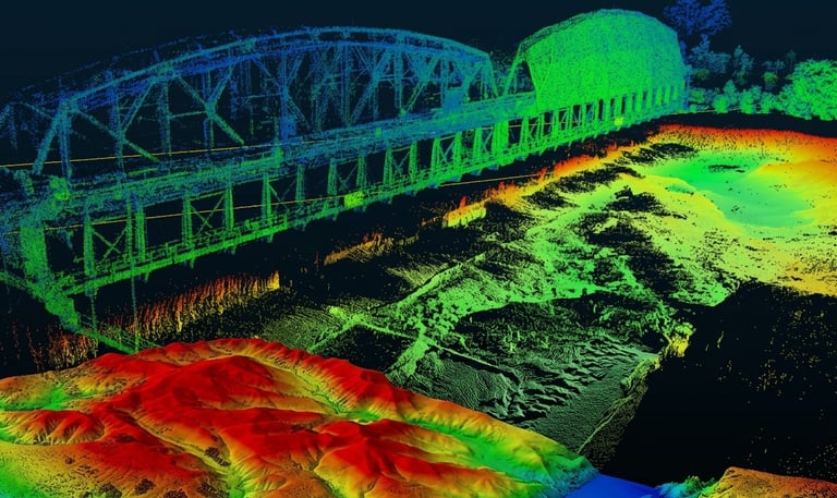
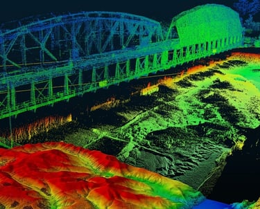
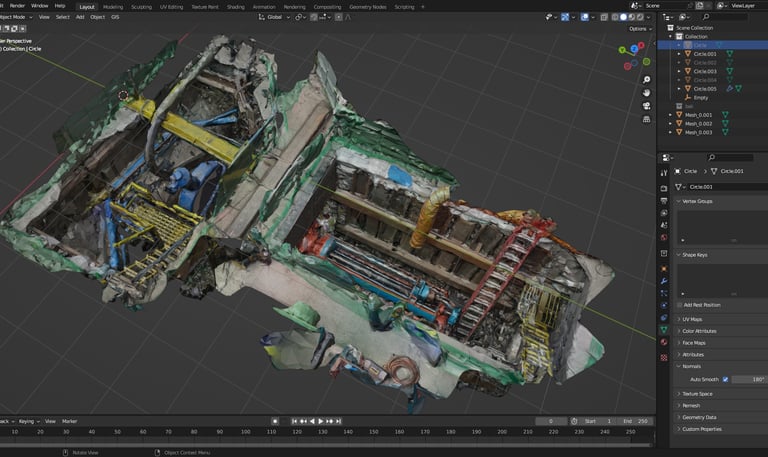
Infrastructure
Our Drone technologies and advanced artificial intelligence evaluate soil and rock information to determine stability, assisting engineers in creating safer foundations for major infrastructure.
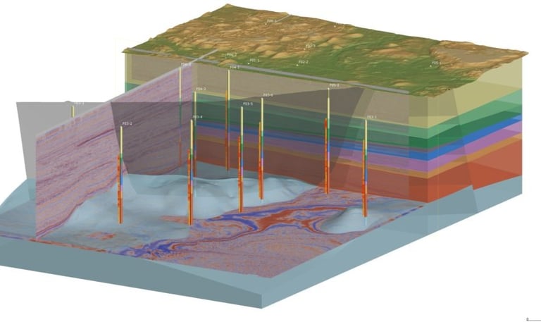
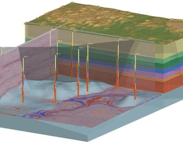
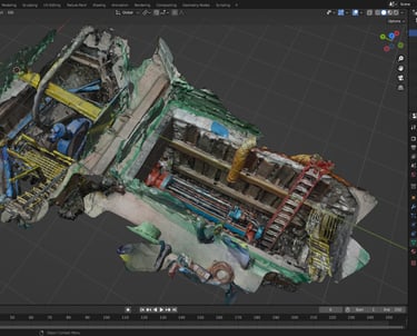
Mining
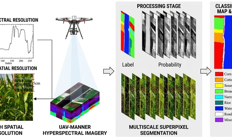
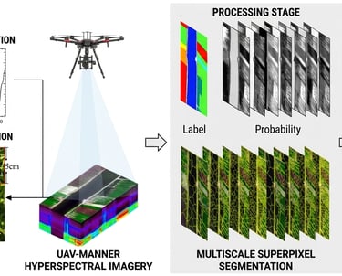
Our technological framework offers valuable data and support to empower farmers in achieving greater yields and high-quality produce. We employ hyperspectral sensors for analyzing soil and monitoring crops, a drone sprayer for planting and fertilization, and heavy-lifter drones for logistics, all optimized to facilitate the complete planting process.
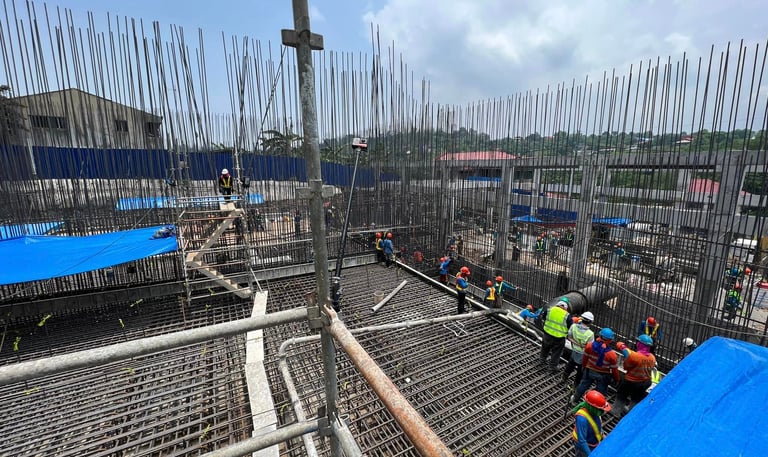
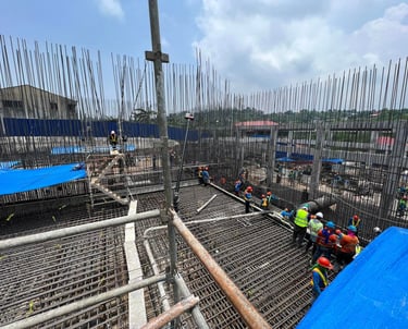
Construction
Our technology, powered by AI, integrates geospatial and geological data to provide actionable insights that enhance decision-making for extensive mining projects, from exploration through mining operations to remediation.
Energy
Our AI-powered solution integrates geospatial, geological, and geotechnical information, providing actionable insights that enhance decision-making for extensive construction projects throughout the planning, execution, and as-built phases.
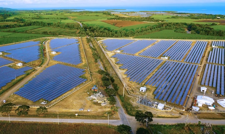
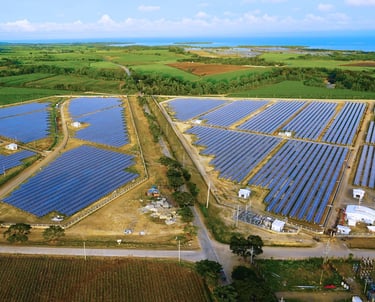
Our AI-powered platforms deliver essential data from power generation to distribution, making sure that all risks are recognized and addressed. Additionally, we leverage our efficient data strategy for everyday operations, guaranteeing that the infrastructure remains in peak condition.
Agriculture
Utility
Our AI-powered platforms collect and assess both surface and subsurface information to oversee utility resources. Utilizing our data, we can evaluate its qualitative and quantitative state.
Get in Touch
Reach out to data360 systems for tailored drone and AI solutions.
Phone
+639171234567
info@data360systems.com